
Innovative geological survey platform for direct vision of gold, water, oil and more resources
Two different geological approaches
Most current geological technologies are based on different indirect methods which involve that scientists collect various physical data and then mathematically analyze all of them, trying to calculate the location area of required minerals, gold or oil.
Sometimes it works. But, in many cases, not so much. Very often after spending many years and huge investments for exploration works, some 40-45 % of oil wells still prove to be empty.
This is why we only use direct methods ! It means we just “can see” the real picture of mineral fields as if they were on a photograph.
Basic Concept behind the Platform
Minerals in the ground are effected by both, external emissions from the Sun and internal emissions from superheated magma in the depths of the Earth. As a result, all elements and minerals switch to kind of excited state.
Therefore gold, water, hydrocarbons, precious metals and diamonds all generate intrinsic emissions and leave distinctive signatures that can be observed on satellite images. These data are processed in the laboratory and their spectrum can be recorded during field surveys.
Components of the Geo-Platform
- Unique technology for express analysis of vast territories allows to outline the most promising areas and exclude territories of no interest.
- Exact delineation of the field in 2D format allows to get more precise in-depth pictures of mineral location.
- Unique deep-ground 3D-scanning, which can filter several kilometres down, gives an exact image of mineral allocations and its amount over the territory.
- Field stage with on-land geo-radars for final coordinates verification of underground structures and pinpointing the best locations for water boreholes or gold pits.
Successive stages of remote geo-scanning
The geological platform “Geo-Inntel-Service” is a convergence of unique little-known geo-scanning technologies. We use successive approximation methods to receive the most accurate data in the brief period of time. Most part of works may be done remotely.
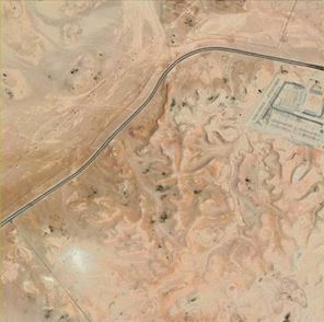
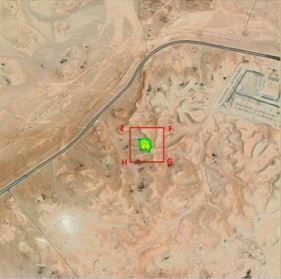
Stages of geo-surveys in África
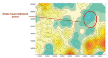
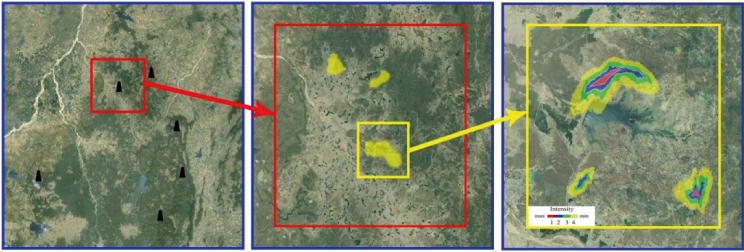
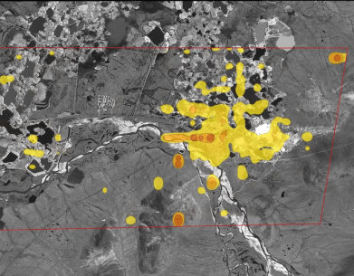
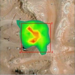
Step 1. Express Analysis of the whole Territory
Example of Gold fields in Africa (made by surface scanning – depth is no more than 10-50 meters)
Objective of first stage is to eliminate all “useless” territories and save budgets
In many cases, 70-90 % of the territory is “useless” with respect to concrete minerals, gold or oil. Such mineral-free zones are not worthy any investments and efforts.
Knowing these empty areas in the very first stage of the project is absolutely precious for any prospecting company.
Proverb says: “It is very difficult to find a black cat in a dark room, especially if there is no cat there”. With gold, oil and water situation is same.
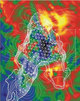
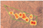
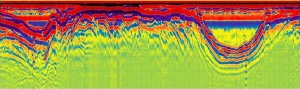
Step 2. Delineation of mineral fields in 2D formats (Deep scanning)
Example of Oil Fields in 2D format (deep scanning down to several km)
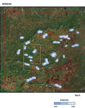
Delineation of gold fields in 2D formats – Deep Scanning
Gold Fields in 2D format (deep scanning)
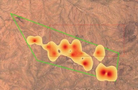
Gold Fields in Africa in 2D format (deep scanning)
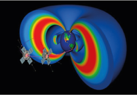
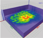
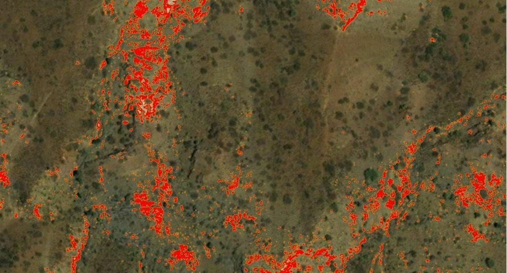
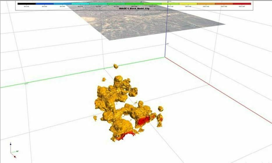
Step 3. Unique underground 3D scanning
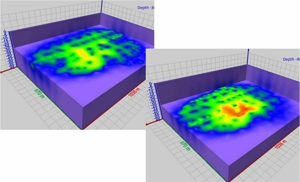
Exact image of allocation and total amount of gold, water, oil or any other mineral on the territory (down to several km.)
Deep ground 3D-scanning. Virtual boreholes.
No need to test drill ! We will make virtual boreholes !
Result of 3D-scanning and virtual drillings
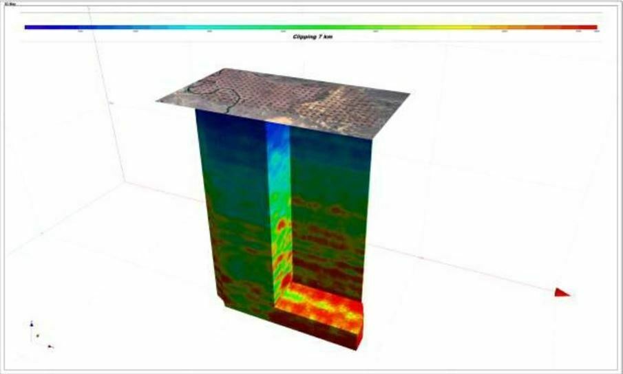
Exact vision of the mineral field in the ground
Result of 3D-scanning – total amount of gold on the given territory !
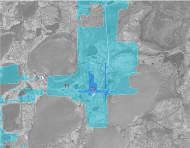
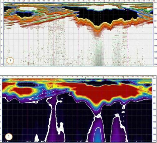
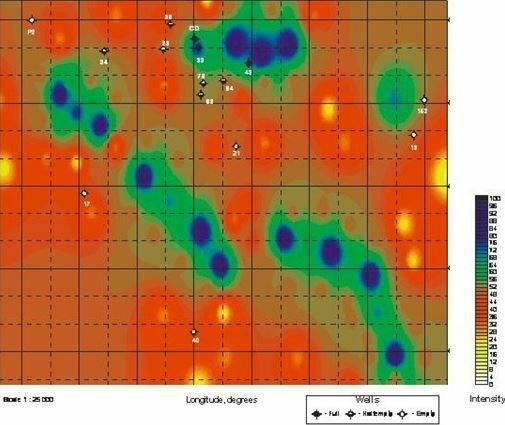
Example of realized project for water search by 2D / 3D scanning
Initial Area of Reseach
Source of underground water found
Gradient of water abundance– red areas are the best for the drilling
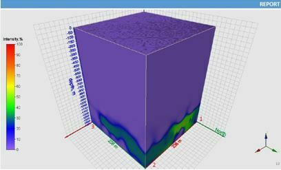
Image of real underground structure
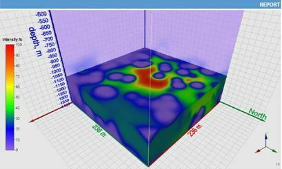
Image of real underground structure
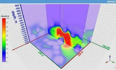
Image of real underground structure
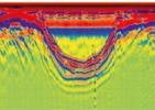
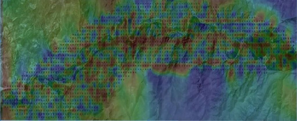
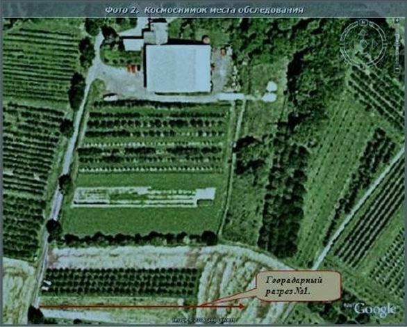
Final on-land scanning with geo-radars (for gold and water)
On-land scanning with use of special unique equipment will provide detailed picture of all hidden structures in the depth. In the picture you may see underground river-bed and layers of gold on it !
Examples of on-land scanning with geo-radars
Underground lake discovered in South America
Search for underground water in Europe
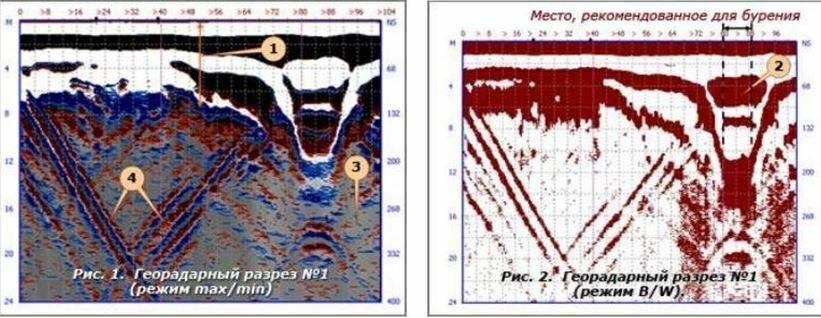
Search for underground water in Europe discovered water paleochannel ( fig. 2)
Special geo-radars are very useful when it is necessary to outline a series of relatively small objects
For example water wells